Translations:GETTING THERE & DIRECTIONS/7/en-gb
Jump to navigation
Jump to search
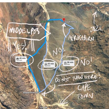
https://goo.gl/maps/UTaozzZLdjAH1Ys98

The light blue lines are the available routes but lead through private farms, these routes are not public and have many locked gates. Google maps chooses the shortest route to AfrikaBurn, but you need to stay on the R355 until you see the sign for the Tankwa Karoo National Park, Middelpos (R354) Sutherland.
