File:Map to get to Quaggafontein & AfrikaBurn.jpg
Jump to navigation
Jump to search

Size of this preview: 418 × 599 pixels. Other resolutions: 1,429 × 2,048 pixels | 6,195 × 8,875 pixels.
Original file (6,195 × 8,875 pixels, file size: 3.02 MB, MIME type: image/jpeg)
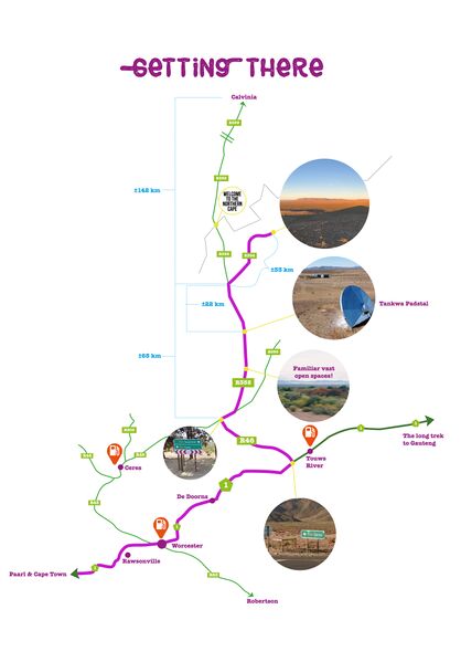
Map to get to Quaggafontein AfrikaBurn from Cape Town, Calvinia and N1
File history
Click on a date/time to view the file as it appeared at that time.
| Date/Time | Thumbnail | Dimensions | User | Comment | |
|---|---|---|---|---|---|
| current | 09:48, 4 December 2021 | | 6,195 × 8,875 (3.02 MB) | Djinni (talk | contribs) |
You cannot overwrite this file.
File usage
The following 3 pages use this file: